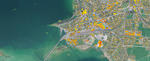
Solar Cadastre
Solar potential of all rooftops
Radiation values for any roof surface
Based on the roof information from a digital surface model or a 3D building model and Meteonorm, the average annually available energy from solar radiation is calculated for each roof surface. The direct and diffuse radiation is determined for each hour of the year. The influence of horizons (other buildings, big trees, topography) is taken into account.
The solar cadastre is digitally processed as a GIS-compatible layer. If desired, the solar cadastre can be processed as an independent customer-specific web application.
Current monthly values for PV system monitoring
As an enhancement of the standard solar cadastre, Meteotest offers a solar cadastre 2.0 with up-to-date monthly values. For each roof surface of a municipality or region, the radiation values and the expected electricity yield of the previous month are presented and compared with long-term values.
With a web application, PV system owners can thus compare the desired yield with the actual yield of their plant - an easy way of monitoring one's PV system. A good example of this is the solar cadastre of the municipality of Belp. Meteotest has developed a similar technological solution for solar potential analysis for the Swiss national project sonnendach.ch.
Real weather data as base data
In the field of irradiation data, Meteotest has developed a worldwide-leading climate database with the product Meteonorm. With this software it is possible to display the radiation data for a typical year for any location in the world. In Switzerland the quality of the data is particularly excellent, thanks to the high station density and the inclusion of satellite data.
The calculation of the solar cadastre is therefore based on real measurements and takes into account the local weather conditions.
Unique algorithm for the identification of roofs
Ground plans of buildings and a digital surface model (DOM) serve as the basis. The DOM depicts the permanently visible surface and thus include forests, buildings and other structures.
With the aid of the ground plans, the buildings are cut out of the DOM. Then the individual roof surfaces are automatically identified with high precision by an algorithm developed by Meteotest. The orientation and the inclination can then be calculated for each detected roof surface.